Travel
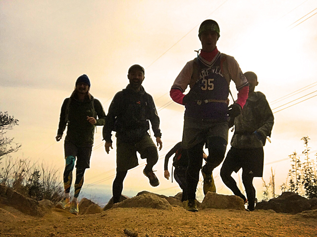
Take a hike! Hiking Mt. Rokko
Take your cue from the crisp, fresh air – head outside and explore.
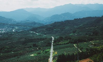
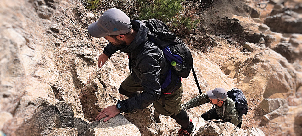
There’s no better way to explore the Rokko mountain range than on your own two feet. Perched between Osaka and Kobe and standing just over 930 meters above sea level, Mt. Rokko provides one of the most renowned hiking experiences in Kansai. There is an epic panoramic view of Osaka Bay from the top of Mt. Rokko, and an exquisite night view over the city of Kobe. The best part is that you can enjoy mountain hiking and hot springs all in one day; Mount Rokko is close to Arima Onsen, perfect for a post-hike soak.
Reaching the summit ridge of Mt. Rokko from Hankyu Ashiyagawa Station should take about four to five hours for the average hiker. From the station, you will follow the small river towards the forested foothills where you will twist along a variety of sizable homes and gain a small amount of initial altitude. The trailhead is essentially a shrine that sits next to a waterfall and the trail quickly corkscrews up over rocks. From the train station to the initial section of the trail is roughly 1km and the route is fairly popular, especially on weekends.
The climb is rocky, but there are chains and ropes along some sections to make things a little safer and easier. The hike is slightly more challenging than other day hikes around Kansai, but the views and wildlife make it well worthwhile. Halfway up, around 450m of elevation and about 1.5 hours into the hike, there is a section of rocks next to the power line that is a common place to stop for lunch. Many seasoned Japanese day hikers bring their gas stoves and cook hot meals at this particular spot. It is also extremely common to see inoshishi (wild hogs) around this common rest spot (attracted by the aroma of freshly cooked noodles or bento lunches). It is important, however, to be cautious around the inoshishi, and also to refrain from feeding them, as they tend to be a bit aggressive. There are also wild mountain cats that often appear at the base of the mountain stretch, and also around this mid-way point.
The view from the side of the Rokko mountain range is of Kobe City, sandwiched between the mountains and the ocean. There are stunning panoramic views at various points along the trail. As the elevation increases, some of the trails run along the fairways of a golf course, so look out for errant golf balls along this particular stretch of the hike. At about 800 meters of elevation, and roughly three hours into the hike, the forested trail opens out into a wide plain with gently rolling hills. This spot marks another wonderful opportunity to stretch out and have a rest. The trail from the end of this mountain plain to the top of Mt. Rokko is covered with a fair amount of bamboo grass.
The summit ridge of Mt. Rokko, running from the peak of Mt. Maya to the peak of Mt. Rokko, is fairly developed and there are a number of parks, tourist attractions, and even a ropeway and a cable-car station for an easy descent, if you choose this option. Some of the more interesting places to visit along the summit ridge include Rokkosan Pasture – a petting zoo and farm, the QBB cheese factory, and the Rokko Alpine Botanical Garden.
There are four main options for the descent of the Mt. Rokko hike. The first and the quickest is the lazy way; the cable-car option. The views are nice from the Mt. Rokko cable car, the trip is quick, and it costs ¥590 one way. It also brings you back to the foothills of Kobe City.
The second-longest option, which is highly recommended is the onsen option. Arima Onsen is one of the most famous onsen villages in Kansai, and is roughly 5km from the summit of Mt Rokko; over the back of the mountain, and is reached following a major trail. Ashiyagawa to Arima, over Mt. Rokko, is roughly a six to seven-hour hike. The two most prominent public baths in Arima are the gold onsen (kin-no-yu) and the silver onsen (gin-no-yu). Day visitors can purchase a discounted ticket to visit both onsens on the same day for ¥850; individual tickets are ¥650. The gold onsen features a free outside foot bath, which is usually quite crowded, and clay-colored indoor bath, with one bath kept at a piping-hot 44°C. The silver onsen is along a back street and has a smaller indoor bath facility. It is not as popular as the gold version.
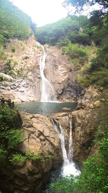
The third-longest descent option is to hike down to the summit of Mt. Maya and follow the trail down to Shin-Kobe Station. This option allows you to arrive in the middle of Kobe City and offers a very convenient exit to a lovely day in the mountains. If you take this descent option, you can enjoy nice views from the Nunobiki Herb Garden and the Nunobiki Waterfall before reaching the station. It should take you roughly eight hours from Ashiyagawa Station to the summit of Mt. Rokko and Mt. Maya down to Shin-Kobe Station.
The longest descent option is to extend your hike and enjoy even more trail on your way to the city of Takarazuka. The initial part of the trail is along the mountain road. This option is about 15km from the summit of Mt. Rokko to Takarazuka Station. It is a popular descent option for trail runners because it pushes the hike to roughly 22km in total, with the majority of climbing in the first 7km. This option should take roughly 10 hours of hiking.
Any way you choose to return from your Mt. Rokko adventure will provide you with a wonderful day out, some stunning photographs, and a few stories to share too.
Useful Japanese
Useful Kanji to navigate trails and maps for this hiking experience:
Mount Rokko (六甲山)
Mount Maya (摩耶山)
Arima Onsen (有馬温泉)
Ashiyagawa Station (芦屋川駅)
Takarazuka (宝塚市)